
 Another bike ride out to Shinigag (Blair Atholl) and then a short walk to an area I’ve wanted to go to for a long time but due to an annoying lack of fitness unable to make the journey until now.
This time it was to explore a large group of shieling bothies on the south side of Lòn Mòr, actually I think this might constitute being a settlement of sorts, consisting of some twenty plus individual buildings that includes enclosures and pens (milking ?).
Located below and slightly to the east of the impressive Creag Bhreac, between it and Creag Spardain (that’s higher and slight further back) so managing to get more sunshine due to the gap between the two. This is an odd location, even though located to get the best of the sun during the normal shieling occupancy times, it still would get any northerly and westerly winds full on as they mostly face NNW (see image below). Obviously though a location that was still deemed suitable, or their options were limited. Most of the lush sun soaked grazing ground is on the opposite side that gets uninterrupted sunshine, with just rough grazing on the more boggy lower ground of Lòn Mòr between.

 The settlement, now consists mostly of turf covered footings, with some that are small enclosures and pens, most of the bothies are of the usual design, with occasional variations of size and construction, mostly sub rectangular.
Quite how the inhabitants existed is unknown, each building relatively close to each other making for a close knit community. A water course and source cuts a third of the way through, including a rather nice small picturesque waterfall. I suspect that most of their livestock was grazed on the high ground to the south, up and to the back of the settlement, or on the opposite side. However there are quite a few bothies on the opposite side so what or rather who was responsible for which area is again unknown. The other question is what livestock they were tending; a few sheep, a cow or two, maybe some goats that can handle the craggy areas unlike sheep or cattle. While there are enclosures these are relatively few and none that would accommodate many animals. Milk cows for sure as milk constituted a vital part of their diet. Quite what livestock was accommodated given the surrounding terrain would be fascinating to find out. And if each bothy was for a singular family, what and where did each family tend their animals.While nearby settlements/shieling areas are named on maps this group is very surprisingly given its size is not. The other settlements are actually much smaller so why are they named and not this, was it abandoned very early on and thus deemed not worthy but that would make it late 16th - early 18th century at least. Research at the Blair Atholl castle archive might shine light on a name but it does seem odd that it is not on any of the early maps by Dorret or Arrowsmith, nor OS. However, on the Stobie / William Johnson map of 1802-1840 (Link) there is marked a settlement called Strondrum straddling the road from Strathardle. Could this be our settlement, whose name disappears. Even the late John Kerr never mentions it in his books on the area, land he walked over frequently.

The nearby farmstead Druim nan Aigeach (Drunanagnach) and a lovely roundel with a large area of ground to the east are within a scheduled area but the settlement, just a stones throw and adjacent to the scheduled area is not included, not unsurprising as this area lacks being properly recorded or on any database. Trove yet again giving minimal information, likewise Perth and Kinross Heritage Trust. A hut circle is also outwith the scheduled area.
 The nameless (as far as I can ascertain) group of buildings is on and cut through by a narrow track, possibly the route from Strathardle to Aldclune track via Glen Girnaig. The track is just wide enough for a horse rather than a horse and cart. I’m sure though there was more than one way to travel down the length of this small glen (Lòn Mòr) maps indicate so but not it appears by this settlement. The more contemporary (?) estate track is on the opposite side, there is no obvious track joining the two locations and the way up to the track in most places is a short steep clamber, the wide track being part way up the south facing hillside.
On the north side there is a very nice roundel enclosure with an accompanying building, an adjacent flat area and what could be either a lime kiln or a grain drying kiln, seems similar to both, I couldn't ascertain a flue, definitely an expert required.
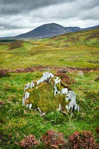
It's a complex area with many traces of change over the centuries. On the north side there is a hut circle (possibly two) so the landscape has been peopled for a very long time. There also is a standing stone (outwith the scheduled area) that is either a more contemporary marker or of great age. It is worth noting that the word Strondrum means "The nose of the ridge" or "The promontory ridge.” Which given the stones location is just that 56.77371° N, 3.68662° W (NN 9702265950) and a short distance from the settlement.
Outwith the concentrated number of buildings of the settlement there was a once very populated surrounding area. The land, the people and the transformation of agriculture over centuries, is a fascinating subject. A landscape whose history needs protecting.
The shieling/settlement will get another visit as soon as possible, there is still so much more to explore.


Images from top: Druim nan Aigeach farmstead; Lòn Mòr; Satellite image of settlement; Druim nan Aigeach farmstead with Carn Liath; Standing stone (?) and Carn Liath; Roundel looking SW; Bothie; Possible lime or grain drying kiln.