Occasional Ramblings with a Camera

This blog is my occasional ramblings on here, there and about, with and very occasionally without a camera. Photography, art, landscape (principally Scottish), heritage and wildlife are the things that interest me the most, so thats what I'll be writing about and of course showing pictures of. They say that a photograph is worth a thousand words, well I'm not so sure about that but if it is then great as it will save me a heap of typing, all power to the image.


Druimchardain Garden

10-02-2025

I was commissioned late 2024 to photograph a garden created by Geoffrey Dutton (1924 – 2010). Bio chemist, poet, writer, editor, mountaineer, wild water swimmer and not least gardener. With 200 published books to his name.

Link to my images: HERE.

I call it a garden book cover

Though now semi wild the garden is still a place of interest and really rather wonderful. I asked his daughter who now oversees the garden if I could continue to photograph for the follow year, which she agreed. The plan was to come and photograph regardless of the weather conditions one day a month and for me to create images that reflect the unique location and Geoffrey Duttons work as gardener and poet.
As of February 2025 and four visits the garden has been in its winter state, skeletal in form so it will be interesting how the images progress into a lan

dscape full of leaf covered trees. So far there has been no significant snowfall so in part the year will on my visits illustrate the weather.

The garden is at a marginal place between the Scottish highlands and the lower more fertile lowlands. Dissecting part of the garden is a deep gorge with waterfalls and swimmable pools if brave. Though now overgrown in part and many of the more tender plants that Dutton planted have not survived tit still remains very much a garden.

'I Call It a ‘Garden’, a Place of Seeds: Geoffrey Dutton’s Lessons in Curiosity and Exploration.'

A small book of the garden and the result of a research project by Barbara Prezelj, ESALA, ECA, University of Edinburgh, commemorating Dutton can be downloaded as a PDF: HERE. (a bit slow to render but it will).

The book contains images (mine and by Dutton) and excellent essays by; Alec Finlay; Billy Lucas; Barbara Prezelj; and poems selected by Kirsty Jones, with one written by her following the death of her father.

The Old Roads to Strathardle

03-06-2024

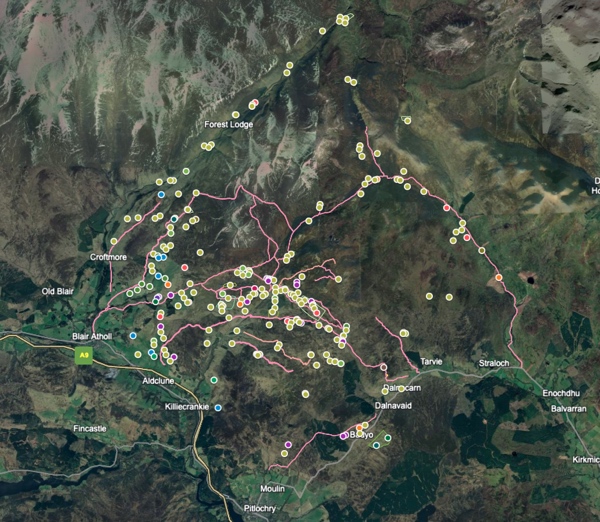
Google map

Between Glen Tilt and Glen Fernate, with the smaller glens between of Fender and Girnaig is an area that encompassed and maintained over many centuries an agrarian population. The extant evidence including hut circles to small settlements/farmsteads with a range of shieling sites comprising of numerous shieling huts (or bothies) in the upper regions, also to be found scattered throughout the area are many lone huts, perhaps these more accurately as they are not immediately associated with a particular shieling area should be called bothies.

The area of approximately 220 km2 was served by several main tracks that aided the transportation of livestock and general movement to the shielings and areas of settlement. Many of the tracks have disappeared through lack of use and demise of the population but several of the main routes can still be traced if at times vaguely. Several of these tracks have been upgraded and are now part of the estate vehicle (inc. atv’s) access. Observation of the tracks will show in certain areas considerable braiding or variation from any singular route.

The Google map (LINK) (Google Earth LINK) was created partly knowing the area and visiting its various shielings but also through discovering the work of John Kerr who wrote ‘The Old Roads to Strathardle’ and ‘Life in the Atholl Glens’. amongst other books about the area. Kerr had walked over and recorded details of the shielings and settlements, especially noting their names through research of various sources but specifically the estate archives of the Duke of Atholl and Robertsons of Lude. These two families for centuries being the principal landowners of the map area. 
Kerr gives statistical context, specifies locations plus names to the principal shieling sites and importantly names to many of the people and also the rent they paid, as well as indicating the routes travelled. These routes took people and livestock not only from and to their various farms etc. down in the lower strath by the River Garry and Strathardle but also to the principal markets at Moulin and Kirkmichael, amongst others over the years.

The routes were also used by drovers bringing cattle down from the north of Scotland. They would also have had overnight stances in the area for the livestock.

The various sites indicated came and went over a considerable period. Ending with just the one main area farm that we see today at Monzie, smaller farms are found in Glen Tilt, Fender and Fernate. Changes in agricultural practice, land ownership whims, the industrial revolution, wars (Napoleonic), improved social standing amongst other factors would see the eventual demise of people living and working in the area. There was it seems initially relatively minimal impact of people being cleared from the land in this area, this did happen latterly but generally it was gradual compared with many areas of land cleared for sheep elsewhere in Scotland.

The Google map is fairly self explanatory with what the dots indicate. The main thing is that the yellowy green dots include both shieling related and various settlements, lone shieling type huts are just that, outlying huts that served a now lost purpose but are an important element in the landscape. It was just easier to lump those shieling settlement sites all together for the purpose of the project.

Hut circles are purple and fanks and roundels are red, blue dots are miscellaneous historical sites.

Very few of the sites are recorded on the main Historic Environment Scotland main database Canmore (Note: Canmore no longer exists with HES transforming it into a single database called Trove) (https://pastmap.org.uk/map). More information can be found on the Perth and Kinross Heritage Trust interactive map (https://www.pkht.org.uk/pkher/) with links to HES for more details. The PKHT interactive map does cover several patches of deserted settlements that are now scheduled. No database features the numerous shielings or lone shieling type huts, bothies or enclosures etc..

Of great help was Stobies map of 1783 and as you can observe around Shinagag there is some confusion as to what can be identified on the aerial imagery. (National Library of Scotland Stobie Link) Also the map by Thomson, John, 1777- ca. 1840; based on Stobies map (National Library of Scotland, Thomson Link) this in particular like Stobies shows many named settlements are hard to locate and many of the 'Shieling huts' might well be some that are named by Thomson.

The map was created using Google my maps, but Bing aerial was also used extensively along with Apple map aerial. Both Bing and Google Earth allow for changing angles and moving around to show sites in relief, Google Earth in particular helped to determine if a site was as it seemed as it gives much more ability to zoom in and out, angle and rotate that helps viewing a possible site and its structural relief. It is important to refer and check with the various aerial sources as they vary in quality and get updated reasonably regularly. Update: Apple maps (same as: satellites.pro/uk) now has the best aerial/satellite imagery and if you click on 2D you can zoom in even more as well as tilt etc..

As many sites as possible have been noted but there will be several undoubtably missed or questionable as, hence the occasional '??' after names. There will of course be false optimistic observations and the map is just a start that can and will be updated and corrected. Usually sites are double checked by doing a walkover for confirmation but for the purposes of this project that hasn’t always been possible. Names to might need correcting but as spelling frequently changed across different maps… The gaelic meanings also might be open to variation.

This is the Link to Google Earth that should work showing the name of sites. I can send the latest base kmz file if anyone wishes.

Let me know of any observations or corrections.

Covid Memorial Book

12-03-2024

Covid Memorial book

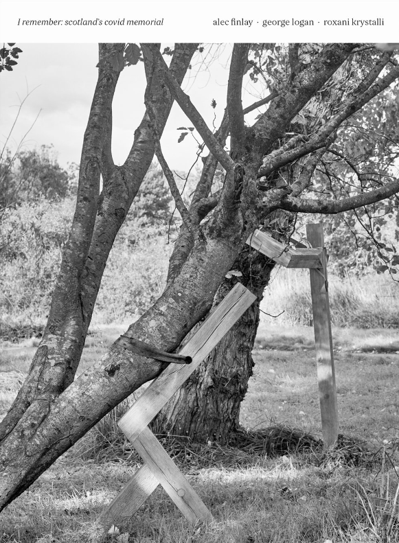
The covid memorial photography and book (I remember; Scotland's covid memorial) that I have been working on over the past few months is now done and available to purchase. £7.50 plus p&p here: https://www.alecfinlay.com/books (29 b&w images + text). 

This was a collaboration with Alec Finlay who created the sculptures in Pollok Park, Glasgow. He was looking to find a photographer that would be in sympathy with the sculptures and produce a collection of images that would bring the project to an end and be a document for the future. He approached me having seen my Carse of Gowrie images, as well as seeing where my interests lie through various twitter posts, that are broadly similar to his own.

It was a good project to work on despite the short timescale, as it had to coincide with the memorial day on the 3 March 2024. The weather at the end of 2023 when I started was abysmal with only a few good days allowing me to travel down to Glasgow. I'm fine with a bright overcast day but dull and raining less so though I did have to deal with that on a couple of occasions.

I wanted to make images that not only showed the sculptures in context but would work on other levels and be work you could come back to and perhaps see and feel something else.

We selected what images I had and sequenced them as best we could with Alec doing the heavy lifting as far as the book was concerned, I corresponding with the designer on image matters and a few tweak suggestions.
There was not a lot of money for the publication and so certain restraints come into play but though small it turned out rather well, I'm very pleased with it, the bulk of the book being the photographs, preceded by an Introduction by Alec and an essay by Roxani Krystalli.

I've uploaded a selection that are not in the book but are some I'm very happy with, they just didn't fit the sequence etc. HERE

Auchenchapel archaeology map

06-05-2023

google map of Auchenchapel archaeolgy sites

This (LINK opens in new tab) is a Google map I've put together showing the various archaeological sites I've found and recorded. There are a few that were previously recorded by other but in the mainit shows those I've recorded.

The initial area of sites centred around land that seeps down to Auchintaple loch (note difference in spelling), which is 19th century in creation. It almost certainly covers a fair amount of archaeology, like the boundary wall. Further sites added later in other areas in Angus and Perthshire.

Many of these while submitted to Discovery and Excavation Scotland (Historic and Environment Scotland) have yet to filter through to Canmore (??) or other regional data sets.

Gleann Beag Zoomy Panorama

26-04-2023

A new zoomy panorama of Glean Beag, that is just south of the Cairnwell and North of the Spittal of Glenshee on the A93, the road leading to Braemar. LINK

Standing stones, Gleann Beag © George Logan

It shows a medieval / post medieval farmstead landscape on the south facing aspect of the glen. It was taken from the south side that also has a number of interesting farmstead dwellings as well as a nice standing stone setting (pic), probably once a 'four poster'.

The area is rich in history, reasonably fertile for such a mountainous glen but also for its main route north and also east to west. Cateran cattle thieves would take their spoil from Glen Isla and further east back via Gleann Beag and then eventually to the Lachaber region in the west.

Updated

27-03-2023

Most of the website is done. New pictures will be added asap.

There is a very new section for Video that I don't do often but something that when ideas arise I enjoy working on. There is a couple of sound pieces, looking at the idea of rivers being liminal places, transitional places within the landscape.

The fourth video is a collaborative piece that was along with other artwork projected for a joint exhibition at Patriothall Gallery in Edinburgh.

Updates in progress

22-03-2023

Tulip and beeI'm finally updating the website. Taken a while but these things occasionally just do.

There will be more emphasis on my own personal photography and also the handmade books I've been working on over the past few years.

I'll probably also be doing less actual photography as I have such a library of images still to work with. These will be forming the basis of my books and image series.

Of course if anyone still wants me to do some commissioned work then I'll certainly give it due consideration, never say never.

You can find me on twitter these days @57seoras I started doing Twitter but gave it up, then when I had an exhibition last year in Orkney that I needed to publicise started again. If you follow and tune to certain people and organisations etc. that interest you it can be very useful, you can hear about events that you normally wouldn't. Of course you have to ignore or block the rubbish that comes along and I make a point of not following or commenting on anything political. I also tend not to follow other photographers, I get enough images pass my way daily without adding more.

Boswell and Johnson, Acts of Creation

25-05-2021

While I haven't disappeared completely I have been occupied with various projects and reworking older projects. One in particular is the series on the remnant orchards of the Carse of Gowrie (Link) combining those images with Boswell and Johnsons text from their Journey to the Western Isles. This is I've worked into a book form.
Their musing are not just about 'orchards' but a wider perspective on the landscape and change.

Link to the Gallery of images

Glen Almond

19-05-2019

A walk in from the Sma Glen and heading towards Auchnafree. Some snaps.
A good walk with the aim of visiting Clach Na Tiompan chambered cairn with accompanying remnant stone circle (pictured) and a small graveyard. A stunning day (Friday 17 May) in a wonderful glen. No walkers encountered but plenty of road traffic with mostly 4x4's coming and going. There are two main big house/ farm / estate areas; Conichan and further into the glen Auchnafree. A good area to explore further though the walk in (private estate road) can be a bit strenuous.

The corrugated building is lovely though uncertain as to its current use, looks as if it has been a chapel at some stage. The door was open and no one around but didn't seem right to be too nosey.
The roundal or stell is of a relatively recent construction though one stood there previously, there are others in the area though. They can be used to protect the sheep in the winter but also as a general corral. Just above the stell in the same field you can see the two remaining upright stones of a four poster stone circle.

Building Glen Almond © George Logan 2019

Gravestone, Glen Almond © George Logan 2019

Stone circle remnant Clach Na Toimpan, Almond © George Logan 2019

Stell Glen Almond © George Logan 2019

So Long

15-05-2019

Rannagulzion © george logan 2019Thats so long since I last added a post, rather than goodbye. I haven't been idle though these past months, I've recently finished a short Arts & Archaeology level 11 module at University of Highlands and Islands from Orkney. Really interesting and a worth while three months. Especially as I spend quite a lot of time these days working with archaeology in one form or another so to combine the two is just perfect. 

Getting into understanding the medium of photography in relation to archaeology has been fascinating and I've still lots of books to read through at a more leisurely pace now. It also relates on my landscape work that is moving in various directions. Still projects to finish and now the course is finished I can get back to looking for a publisher for my Orchards work.

One area I might look at for a future project is the now in ruin upland farms, an extension from my interest in pastoral farming, farming on the edge. These might have slightly more connectivity as some will have only been unoccupied in the past few decades. How quickly they wither.

Not sure of my approach just yet, various options to mull over.

I'm getting a studio built so that will help in producing work, a better more creative work space. Really looking forward to it being finished, roof just going on and base flooring being laid today.

A few images from yesterday at a farm called Rannagulzion below Drumderg wind farm. Images for me to ponder on more than anything.

Rannagulzion © george logan 2019

Rannagulzion© george logan 2019

Rannagulzion© george logan 2019

No end for Many

05-11-2018

shell shock © George Logan

The war might have ended, an armistice signed but for many the fighting continued.
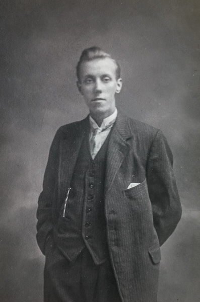
These are images of a now unknown relative, I'm sure the same person. One image before signing up and the other taken while a resident post war(?) while admitted to Perth sanitorium. His uniform while there was pale blue. The photographer has retouched his side bald patch, evident in the before image and interesting that the hands have been shaded out. His 'thousand yard stare' is evidence of the trauma he has and continues to endure. It was this image that inspired my 'Foresight' series of images.

relative person © George Logan

Foresight ~ WW1 remembered

01-11-2018

Foresight © George Logan 2018I've just uploaded a new gallery of images from my 'Foresight' series that was in part exhibited at Patriothall Gallery in Edinburgh last year.

Gallery: HERE

It is of the right eye, the eye that aims via a gun foresight, of soldiers in the Black Watch regiment who fought in the first world war.

Stings like a bee (cringe)

20-09-2018

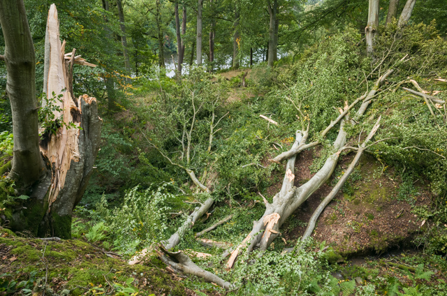
Cargill © George LoganCargill © George LoganA short walk down to the river where I live yesterday revealed that storm Ali had put an end to a much photographed mature beach tree that stood on the edge of a small gorge. How the storm had found the tree amongst so many others is a mystery, some other trees had a few branches snapped off. Such is life.
(right click images and 'open in new tab' to view slightly larger)

Cursus in Crieff

28-08-2018

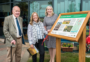
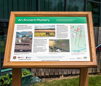
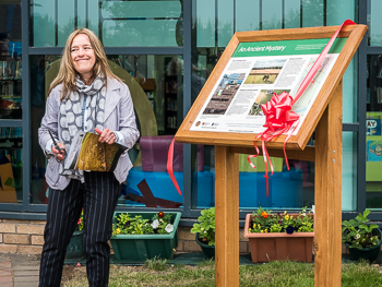
Way back in 2017 I made a photograph with the pupils from Crieff secondary school, part of Crieff Strathearn Campus. It had them line along the underlying archaeology of a Cursus (pdf) that crosses a neighbouring field and road then under the Campus. What must have been a spectacular monument at one time. The photograph is at the top of the panel for which it was intended.

The information (and educational) panel is located at the Campus for all to see. The whole project was masterminded by Ian Hamilton and whose perseverance made it happen. Based on archaeology by Dr Kenny Brophy.

The panel was formally launched on 24 May 2018 and got a good spread of publicity. More info HERE (same pics:() 

© George Logan 2018

© George Logan 2018© George Logan 2018© George Logan 2018