Occasional Ramblings with a Camera

This blog is my occasional ramblings on here, there and about, with and very occasionally without a camera. Photography, art, landscape (principally Scottish), heritage and wildlife are the things that interest me the most, so thats what I'll be writing about and of course showing pictures of. They say that a photograph is worth a thousand words, well I'm not so sure about that but if it is then great as it will save me a heap of typing, all power to the image.


A collection of shieling bothies

14-09-2026

Druim nan Aigeach (Drunanagnach) and Lòn Mòr looking towards settlement © George Logan 2026Another bike ride out to Shinigag (Blair Atholl) and then a short walk to an area I’ve wanted to go to for a long time but due to an annoying lack of fitness unable to make the journey until now.

This time it was to explore a large group of shieling bothies on the south side of Lòn Mòr, actually I think this might constitute being a settlement of sorts, consisting of some twenty plus individual buildings that includes enclosures and pens (milking ?).

Located below and slightly to the east of the impressive Creag Bhreac, between it and Creag Spardain (that’s higher and slight further back) so managing to get more sunshine due to the gap between the two. This is an odd location, even though located to get the best of the sun during the normal shieling occupancy times, it still would get any northerly and westerly winds full on as they mostly face NNW (see image below). Obviously though a location that was still deemed suitable, or their options were limited. Most of the lush sun soaked grazing ground is on the opposite side that gets uninterrupted sunshine, with just rough grazing on the more boggy lower ground of Lòn Mòr between.

Aerial view of shieling settlement © Apple.

Lòn Mòr looking east across to settlement area. © George Logan 2026The settlement, now consists mostly of turf covered footings, with some that are small enclosures and pens, most of the bothies are of the usual design, with occasional variations of size and construction, mostly sub rectangular.

Quite how the inhabitants existed is unknown, each building relatively close to each other making for a close knit community. A water course and source cuts a third of the way through, including a rather nice small picturesque waterfall. I suspect that most of their livestock was grazed on the high ground to the south, up and to the back of the settlement, or on the opposite side. However there are quite a few bothies on the opposite side so what or rather who was responsible for which area is again unknown. The other question is what livestock they were tending; a few sheep, a cow or two, maybe some goats that can handle the craggy areas unlike sheep or cattle. While there are enclosures these are relatively few and none that would accommodate many animals. Milk cows for sure as milk constituted a vital part of their diet. Quite what livestock was accommodated given the surrounding terrain would be fascinating to find out. And if each bothy was for a singular family, what and where did each family tend their animals.While nearby settlements/shieling areas are named on maps this group is very surprisingly given its size is not. The other settlements are actually much smaller so why are they named and not this, was it abandoned very early on and thus deemed not worthy but that would make it late 16th - early 18th century at least. Research at the Blair Atholl castle archive might shine light on a name but it does seem odd that it is not on any of the early maps by Dorret or Arrowsmith, nor OS. However, on the Stobie / William Johnson map of 1802-1840 (Link) there is marked a settlement called Strondrum straddling the road from Strathardle. Could this be our settlement, whose name disappears. Even the late John Kerr never mentions it in his books on the area, land he walked over frequently.

Druim nan Aigeach (Drunanagnach) and Lòn Mòr with Carn Liath beyond © George Logan 2026

The nearby farmstead Druim nan Aigeach (Drunanagnach) and a lovely roundel with a large area of ground to the east are within a scheduled area but the settlement, just a stones throw and adjacent to the scheduled area is not included, not unsurprising as this area lacks being properly recorded or on any database. Trove yet again giving minimal information, likewise Perth and Kinross Heritage Trust. A hut circle is also outwith the scheduled area.
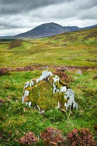
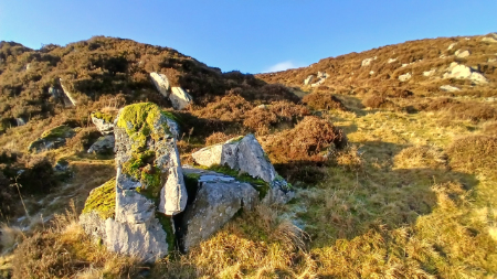
Possible standing stone with Carn Liath in the backgroundThe nameless (as far as I can ascertain) group of buildings is on and cut through by a narrow track, possibly the route from Strathardle to Aldclune track via Glen Girnaig. The track is just wide enough for a horse rather than a horse and cart. I’m sure though there was more than one way to travel down the length of this small glen (Lòn Mòr) maps indicate so but not it appears by this settlement. The more contemporary (?) estate track is on the opposite side, there is no obvious track joining the two locations and the way up to the track in most places is a short steep clamber, the wide track being part way up the south facing hillside.

On the north side there is a very nice roundel enclosure with an accompanying building, an adjacent flat area and what could be either a lime kiln or a grain drying kiln, seems similar to both, I couldn't ascertain a flue, definitely an expert required.

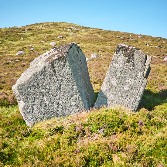
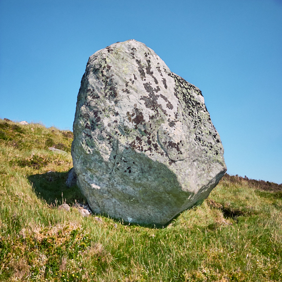
It's a complex area with many traces of change over the centuries. On the north side there is a hut circle (possibly two) so the landscape has been peopled for a very long time. There also is a standing stone (outwith the scheduled area) that is either a more contemporary marker or of great age. It is worth noting that the word Strondrum means "The nose of the ridge" or "The promontory ridge.” Which given the stones location is just that 56.77371° N, 3.68662° W (NN 9702265950) and a short distance from the settlement.

Outwith the concentrated number of buildings of the settlement there was a once very populated surrounding area. The land, the people and the transformation of agriculture over centuries, is a fascinating subject. A landscape whose history needs protecting.
The shieling/settlement will get another visit as soon as possible, there is still so much more to explore.


Images from top: Druim nan Aigeach farmstead; Lòn Mòr; Satellite image of settlement; Druim nan Aigeach farmstead with Carn Liath; Standing stone (?) and Carn Liath; Roundel looking SW; Bothie; Possible lime or grain drying kiln.


Gleann Beag farmsteads and such like

25-08-2026

Gleann Beag ~ Farmsteads and such like.

Farmstead Gleann Beag © George Logan 2026For years I’ve driven past the archaeology on the west hillside of Gleann Beag but never ventured across to the very obvious ruins. Mainly as a reasonable river (Allt á Ghlinne Bhig) inhibits the way with no bridge, only fording spots.
With so little rain recently it was thought that the river would be easy to cross and so it was though somewhat wet feet were acquired on the return. Wellies next time.

Along the hillside are four equally spaced farmsteads with another slightly further north. The first destination was the farmstead called Croinhedie (Roy Higlands, 1747 -52), Cronachoryy (Aaron Arrowsmith, 1807), Crò na h-Airidh (OS Six inch, 1840s-1880s), Cronaherie (Rev. T.D. Miller 1929), Cro Na H-airighe (HES Trove). I’m sticking with Crò na h-Airighe as per recent OS map. How names change with different spelling over time, though rooted to an original.

Trove requires confusingly it’s own exact spelling if doing a name search but to save you the mess that is Trove here is the Link to the information that covers the archaeology rather well and also quotes from the book by Rev. T.D. Miller (formerly minister at Glenshee), Tales of a Highland Parish (Glenshee) 2nd ed.1929. Worth seeking out.

Oddly Crò na h-Airidh is not next to the water course called Allt Crò na h-Airidhe which the next farmstead along is but actually next to Allt Creag Dubhaidh.

Gleann Beag © George Logan 2026

The Ramsey family who were the tenants for decades up until they eventually abandoned their farm and home in 1812. The other tenant farmers in the glen also abandoned what had been their life, work and history. Many emigrated to the colonies were some prospered, if not all. It appears this was not a forced eviction but one of mutual consent, sad time nonetheless.

However, at an altitude of 1509 ft to eke out a living as they amazingly did for decades and in some form probably for centuries was inevitably going to end. Land ownership, agricultural change and the change in society in general. Now only an estate house and units remain at Rhiedorrach across the glen. So in a way life still goes on, if only one family and the workers when needed travelling from further afield by car.

Even though a lot of their livestock, that which the land could sustain, would have been moved south during the winter months, in part the Winter weather but also the issue as in other parts of Scotland of an insufficient supply of feed. Much of the livestock will have been very malnourished come the Spring, those that survived when there was little to nothing to eat over previous months. The weather itself could and did take the lives of many an animal as Rev Miller relates, one farmer in Gleann Beag in the late 19th century lost five hundred sheep and five horses during one particular snowstorm.

Gleann Beag © George Logan 2026The balance the farmers of Gleann Beag must had to deal with is difficult to imagine but they would have had livestock as well as crops to manage, good years and bad. Rain, snow and sunshine, quite possibly all in one day. Systems of management will have developed over centuries, adapting as needs must.
Crops were grown as it is easy to spot the ridge furrows leading down from the farms and enclosures. These will have required plentiful manure from livestock to act as fertiliser as well as lime though the soil in the glen is relatively lime rich and there is a good source apparently on the Cairnwell. Corn and lime kilns can be found at the various farms.

The next farmstead visited was just due south and called Lag nan Cnàimhean (OS Six inch, 1840s-1880s), Lag Nan Cnaimbean (HES Trove, a ‘b’ for an ‘h’), and Laganagriene (the hollow of the bones) (Rev. T.D. Miller 1929). The map in Millers book spells it Lagnagrain. Again here is a Link to the description of this well recorded site Link.

This farmstead is as interesting as Crò na h-Airidh and if you are into drying kilns there is a rather nice example. Grain drying kilns will have been an essential fixture for such a location.

trap Gleann Beag © George Logan 2026

All worth a visit and still plenty to explore. For my next visit I’m keen to see Gorrowmill, Garrow Hill, Gormel, (I despair) that is further to the north and was abandoned in the early 18th century following an avalanche. The occupants managing to survive but obviously enough was enough and moved away.

There also several sites to see further south. Then you have the settlement/farmstead sites on the west side of the glen that include a couple of nice standing stones. A picture of the stones can be found here Link and a link to a zoomy panorama of the area I’ve now managed to walk over.

There are some shieling type bothies on both sides but non were located on this occasion though there was a very nice enclosure spotted on the hillside well above the farmstead and another later noted further along (56.84316° N, 3.42104° W and 56.83688° N, 3.42207° W).

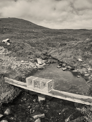
The area and indeed most of Gleann Beag is geared up for serious sporting activities; grouse and deer. Lots of shooting butts and bird feed/grit mounds as well as traps for ‘predators’. On our visit three large herds of red deer were spotted plus one barking roe deer.
How this will settle with those walking the hills I don’t know. It won’t be stopping me if there are no clear indications shooting is in progress, as there should be and I have no objection to that and would take heed.

Take your wellies and cross the river; explore and let your imagination place yourself living a few centuries back and in the landscape that is Gleann Beag.

I've added a small gallery of images from the visit that can be viewed here: Link

Gleann Beag © George Logan 2026

Gleann Beag © George Logan 2026

Gleann Beag © George Logan 2026


Shinigag and some more hut circles + an eclipse

13-08-2026

Hut circle (ring-ditch house) © George Logan 2026It seems this month is Hut Circle Month, following a trip up Glen Moy the other week but this time the destination was Shinigag. In from Blair Atholl and parking at the official parking area by Loch Moraig and near Monzie farm.
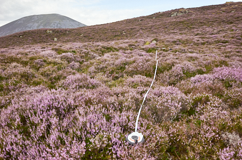
At last, also getting the use of my ebike** and the reason to purchase it, being able to travel into areas thus avoiding a long walk when my right leg unfortunately becomes these days rather painful, it goes numb after a few miles, especially on hard ground, less so on rough and soft ground. I cycled somewhat precariously at times (it's not a mountain bike) to Shinigag a long established sheep station and bothy, water but no electricity for those that once lived permanently there. From Shinigag I walked north west a short distance to some hut circles that I had noted on aerial interpretation. As per Trove (Link) called Allt Na Coille. I hadn’t walked to the site prior to recording that is something I prefer to do. By walking over a site you pick up a lot more about the location, not just confirming the site but also frequently as here identify other related potential sites.

Measuring Hut circle © George Logan 2026

The main recorded and clearly seen from aerial double banked hut circle (Ring-ditch house) is as described and well defined. It sits on an elevated flattish area (top pic) with commanding views to the East and around to the West. The other noted on Trove is a little uphill to the North. I was curious about other potential circles that are less defined. So definitely two hut circles (2nd with tape measure) and I would now confidently add another ‘possible' one or two. I also suspect more in this location will be found. The one just to the north of the second confirmed site is much smaller and is odd in that there is a much wider gap/entrance to the west, so this could at a guess be an enclosure of sorts rather than a dwelling, hence some doubt to it being a hut circle but it is slightly banked and circular. The other is to the north west and is ill defined but there is a clear entrance to the south east, banked to the west though much reduced to the east, circular in form. It measures roughly in line with the others (except pos. enclosure) at approximately 13.7m.

Hut circle entrance © George Logan 2026There are a lot of hut circles in the wider area (see my map) so I’m not pinpointing anything unique here but once recorded they add to the wider landscape and how it was populated in the past. Hut circles it seems are difficult to accurately date without a full excavation and chance of finds or dating evidence (carbon dating), often mentioned as bronze to iron age though I suspect they in certain locations were present in more recent times, perhaps as a non expert guess to early medieval. One question therefore is what was in-between these and the more recent medieval/post medieval shieling/settlement sites. It seems odd to think that the landscape ceased to accommodate people in one way or another for so long a gap. A side note about this latter point; reforesting (even when no forest as such existed ever or for centuries) can and will obliterate traces and even more contemporary archaeology. Planting on enclosure dykes included, as noted in the area.

A final quick visit to two side by side bothies near Shinigag slightly curtailed by a little encroaching rain that…; well someone built and lived in them, thus of note and always worth a visit.

While packing up and helmet on head (am I the only one who feels a right pillock wearing these if rightly a life saver ?) to head back a pickup pulled up, it turned out to be the local shepherd and stalker (Sandy), a friendly chat but what struck me was that here was someone making a living with family and caring for the landscape as so many had done in various ways centuries before.

I waited back at the carpark a bit for the eclipse but though it got slightly darker the increasingly thickening cloud in the area could have just as well been the cause. A disappointment but not the end of the world thankfully, I’ve seen a partial eclipse before. In the time of the hut circles and even the shielings such an event, unknown most likely to the inhabitants will have come as quite a surprise, or even one of foreboding.

** If you can walk then walk and enjoy the connection with the earth and wider landscape but if using a bike then stay off footpaths, clue is in the name.

Carn Liath from Monzie carpark © George Logan 2026

Carn Liath from Shinigag © George Logan 2026


Images(from top): Looking across main hut circle, view south; 2nd hut circle measuring diameter; Entrance to new hut circle; Carn Liath from Shinigag, morning sunshine; Carn Liath from carpark, start of eclipse.

Glenmoye Park, Glen Moy, Wester Lednathie. A search.

03-08-2026

A visit to Glen Moy in search of some hut circles.

Hut circle location © George LoganThe search was for what I envisaged from the very start to be difficult to locate or rather to actually see the hut circles, unlike a lot of hut circles that are generally easy to pinpoint. These are located in Glenmoye Park, an area in Glen Moy (at the end of the public road) and just up the hill from Wester Lednathie a now much reduced farmstead and large circular enclosure, itself located in the 'Park'.
Yes the names become rather confusing and to confuse matters slightly more (such are the rabbit holes when researching) the nearby farm that was once called (1st OS map) Hindhaugh is now Glenmoy farm. The name seems to have changed around 1900 if referencing various maps.
The Wester Lednathie name (as per Trove) I think is wrong as there is a precisely named Wester Lednathie (and an Easter) and a Burn of Lednathie a mile or so west of Cortachy in Glen Uig plus no map mention to that name in the area discussed here. Of course Trove while showing interesting images of the Glenmoye Park hut circles is rubbish with regards finding informative 'Details' of what is I now realise currently being called Wester Lednathie, and the farmstead/settlement there. One would need to consult and confirm with a local or the estate owner (if interested?) for the possible correct and true name, if not just Glenmoye Park (old) farm, but it does seem odd.

Track in Glen Moy © George LoganAnyway, having parked the car at a nice small prepared parking spot (thumbs up) it is just a short walk up past Glenmoy farm, that is now empty and decaying, though the estate did try a little scam in offering people to rent it for a pound if they renovated it, just as a holiday home mind, nothing permanent. Obviously no takers. Further up the track is what might well have been a nice cottage that up until recently had a roof, the slates now stacked it was noticed by the farm. Both have or had electricity connection and TV. The little cottage could have made for a lovely holiday let if suitably renovated, or an actual home. Back down the public road is an example of a small old barn that was indeed completely renovated and turned into a very desirable property (Link)

Glen Moy farmhouse © George Logan

Before the bridge by the small cottage you turn up the track to the left and then into Glenmoye Park itself, a gentle hillside of rough grazing and then head west. This will take you to the much reduced remains of the farmstead/settlement currently and incorrectly (?) called Wester Lednathie. As far as I can ascertain this has never been surveyed and the only information is just a reference to previous maps that indicate “A farmstead, comprising two unroofed buildings and one enclosure annotated 'Sheepfold' is depicted on the 1st edition of the OS 6-inch map (Forfarshire 1865, sheet xxv). A number of walls which may be part of the building and the enclosure are shown on the current edition of the OS 1:10000 map (1972).” This is very misleading as you will easily see on the ground and aerial imagery that it is in fact a very complex and extensive area with numerous buildings. Well worth exploring and trying to figure out what the buildings actually constituted, one looks like a drying kiln but also certainly several byres and of course the nice circular enclosure. There are also at least five interesting bothies just to the north, all curiously widely spaced from each other. Plus a stand alone rectangular enclosure similar to another but square enclosure that has been integrated with a boundary wall, there is the possible remains of another to the north with a possible bothy, another standalone bothy can also be seen. A line of stone shooting butts are located near to the boundary wall. This whole area would benefit and be an interesting project to survey, even if ‘just’ in part post medieval. There are several other ruinous buildings in the wider landscape (ie. Shank) and you will see that a lot of rig (ridge) and furrow cultivation has taken place in the past.

Gable end of small cottage © George Logan

However the hut circles are much much earlier and are located with areas of enclosure a little to the north west and uphill of the farmstead. These are near impossible as I discovered to see on the ground, certainly mid summer with the long tussocky grass, though from Trove (snow cover) images (Link) and Apple Maps aerial (or here Link) they can be very faintly made out. I did ascertain what I think to be their location following the grid reference, on slightly level ground there is a hint of a depression within a vague circular area.

Roofless cottage Glen Moy © George LoganThe highish location looking down to the burn is interesting and that there isn’t a water source except the burn aways downhill, not even a hint of an old spring or flush adjacent, the farmstead slightly further down looks as if it had a water source though. That the huts would have stood with the full force of a north wind, as with the bothies further down the hillside is also curious, offering no shelter. There are a few tree stumps nearby from a former woodland (Glenmoye Park Wood, circa 1900) but what the tree coverage there was and shelter from in past times is questionable. 
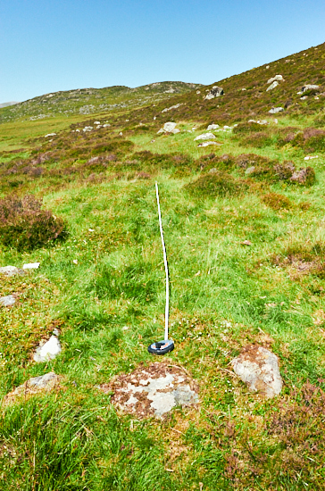
It appears from the various photo sources that there are two large huts and possibly others much smaller. LiDar when it gets done should reveal a lot more information on this location as a whole.

Glenmoye Park is an interesting area and for a bit more energy you can pop over the hill to another ruinous settlement called Cuilt named on Timothy Ponts map of 1600 (as Cult) or the more contemporary farmstead Glencuilt, then walk back the adjacent track that takes you to the public road. Option of course to do this clockwise.

The hills around are bleak and extensively scarred by muirburn but still an area well worth a trip to locate the archaeology and evidence of past lives for yourselves.

Images (from top): Location of hut circle, Estate track into Glen Moy, Glen Moy farmhouse, Gable end of cottage in Glen Moy, Roofless cottage in Glen Moy.


Crungie Clach revisit

28-07-2026

Another walk to the bothies on the lower slope of Crungie Clach, a very well named hill given its stoney nature with a good scattering of exceedingly large boulders. I walked in this time from Clunskea glen on the east side of Gurlet and came back via the east side of Crungie Dubh. It was exceedingly hot latterly, the initial coolish breeze having died down and quite a slog over some very rough ground, even if not great in distance. On the way a stop at a nice bothy (56.76913° N, 3.64119° W) and enclosure just off the track that I've previously recorded.

Tape measure of bothy © george logan 2026Bothy ruin © george logan 2026

Once I got to my destination I measured all three of the bothy structures plus the small enclosure. The largest I think is actually and unusually two joined bothies, rather than living area plus byre. These are marked and outlined on the OS Mastermap (reasonably accurately) and 25,000 scale map but I confirmed that no record of them exists. Possibly a mention in the Atholl archives but that would require access and a deep dive. There is one (pic with tape measure) not shown on the OS map but then it is quite subtle. A very interesting location with no visible track to it. Down and to the front there is a feeling of a possible cleared for grazing, or at least stone free area, speculation on my part.

After a slightly leisurely time I decided to climb up Crungie Clach and although hot and a steep clamber up it was well worth it, with fantastic views around. Despite the welcome breeze at the top there were numerous Painted Lady and Red Admiral butterflies flying about, a nice little bonus. Back down the hill, more boulders and rough going. A welcome break cooling my feet in a small stream halfway, bliss.

Crungie Clach boulder 2 © george logan 2026

Crungie Clach boulder 1 © george logan 2026

Crungie Clach boulder 2 © george logan 2026


Crungie Clach bothy

01-06-2026

View from bothy with Beinn a' Ghlò in the distance. © George Logan

My first major trip into the hills this year, although really not that far but still a reasonably strenuous walk for me. I headed to a shieling (?) bothy or maybe and more accurately a graziers bothy(s) to check it out. I know part of the route very well but decided to see if following the old Blair Atholl (Ardclune) path further on than before it would continue to be clear as it does initially coming from Strathardle. However once starting to round Crungie Dubh, the track eventually disappears, though it does show up on several maps. Rough ground it was from then on. Numerous deer however kept me company most of the way, small groups and much larger herds.

Rather remotely located (56.77179° N, 3.66308° W) on the west side of Crungie Clach, across Allt na Leacann Mohr from Riecharlotte (Charlottes shieling), see previous post and situated half way up the side of Crungie Clach, just as the hillside becomes more rock strewn. You cannot see Riecharlotte from the site nor the burn, as in front is an extended slightly sloping grassy area (main image) just before dropping steeply down.

Bothy (larger of the two) looking north. © George LoganSomehow I got confused and thought this site had been recorded but actually it was only and rather oddly shown as a building on the latest OS maps and has no record that I can find*. It does not appear on older OS editions. Shielings are usually only vaguely indicated, with a few huts shown or so frequently no reference at all. As per the map it consists of two separate structures, plus an enclosure. There is one lone building (both are mostly grass covered footings) to the north and a few yards south the larger building itself being divided into two roughly equal sized rooms, the very fractionally larger being a possible byre. The small enclosure has one straight side, for reasons unknown.
The view from the west facing entrances is lovely, certainly on the sunny day of the visit, out to a wonderful and far landscape. Behind is the steep slope of the hill that is very rocky, with many very large and impressive erratic boulders. The name possibly derives from the Gaelic 'Cruinn-chlach', meaning 'round stone, or ‘Crungie' relating to the Gaelic 'cruinneach' meaning round or gathered. You decide, it’s very rocky anyway compared with nearby hills. The hill you walk past is called Crungie Dubh ~ Round dark hill, if not actually that dark.

Looking down to the bothies. © George LoganThere is no discernible track route to or from the bothy which is quite interesting as there must have been a reasonably well trodden path of some sort for the people who stayed there. There is a possible enclosure to the front that viewing the satellite image shows as an angular element of heather growth. Down towards Riecharlotte but still on the east side of the burn there is a large area bounded by a well defined earthen dyke (56.77074° N, 3.66859° W), not seen from the bothy. It’s a curious site and has some interesting qualities, one wonders on the relationship with Riecharlotte if any. There must have been some interaction and overlap of occupancy between the two. The coming and goings as well as the droving routes passing by will have at a certain time made for a busy place, certainly not the quiet solitude of today, that I enjoyed while resting in the sunshine.

Just before heading back I noticed a third building, small and much reduced with the barest of outlines just a little away from the main building. Obviously a much earlier structure extending the timeframe and definitely worth recording.
Returning back to Strathardle via the east side of Crungie Dubh to join up again with the old track back downhill. I’ll return to do some proper recording and I think having seen the terrain will go instead via Clunskea glen that though not much shorter has most of the way an old estate track to follow before heading over moorland to the bothy.

It is interesting, to me at least, how the surrounding landscape influences a certain feel for a site, the nature of the site and wondering about the past occupants. This one is definitely worth a return and next time with my tape measure to record.
I’m amazed how poorly documented or surveyed this whole area is, with the number I’ve noted it should be seen in a different light and more fully protected.

A future trip I'll be heading to the dark distant crag you can see on the left in the main image, a whole unrecorded complex settlement of shieling huts.

*There might be a reference in the Blair Atholl or Roberts of Lude archives but my one attempt on another site didn’t get a response from the archivist.

Erratic boulder ©George Logan

Erratic boulder © George Logan

Erratic boulder © George Logan

Erratic boulder © George Logan


Wester Ballindean Orchard ~ 'Saved !'

05-05-2026

Pear blossom and bee ç George LoganA few years ago I did a project on the remnant orchards of the Carse of Gowrie. A small selection of the images can be viewed HERE While still hoping I might get around to finding a publisher I've meanwhile been printing out as many images as possible, so at least they might end up in an archive in the future.

While driving past one of my favourite orchards at Wester Ballindean a few weeks past I notice work was being carried out and I had an initial thought that it was being grubbed up for housing. The owner I knew had many years ago sought planning but was refused and he subsequently left the orchard to go its own way, becoming a jungle of brambles and dense undergrowth, it was nearly impossible to access or walk around. My second thought, if that was the case the trees would have been cut down and not just the brambles, phew! Later I made enquiries and it has turned out that the local community had purchased it. Creating a comprehensive project plan they managed over five years to secure funding and initiated compulsory purchase, as the owner was not willing to sell.

Pear tree in blossom © George LoganIn no short time the 'Wester Ballindean Community Heritage Orchard' group have cleared the brambles, erected a deer fence to mainly keep out the local sheep who had free range previously causing much damage and have had a pond dug amongst quite a few other improvements. Once done there will be a path snaking through the orchard and replacement heritage apples trees planted. The whole of the orchards biodiversity will be enhanced and monitored.
I've taken on the task to photograph it over a year as I thought it a really positive development and a fitting end to my orchard work and general interest in the old remnant orchards.

The timing to has been excellent with the damson and pear (pictured) blossom exceedingly lovely this year, a sound start. Apple blossom just following on from the pear. With such a good sunny and warm(ish) start it will be interesting to see if the fruit are as abundant. To see the orchard change and made accessible will be lovely also, the chance for flowers to emerge that previously were smothered by the brambles, it will still take many years but all credit to the community for their interest and dedication to see the project through.

The group have a facebook page.


Tigh nam Bodach a truth and fiction

17-02-2026

Some informed research and thoughts.

Once upon a time.

There was an entertaining tale told to children and delighting one can imagine the adults also, all about the Cailliach, and of spirits, hospitality and subsequent good fortune that might befall. A tale widespread and told no doubt with variations amongst the folk of the glens and when staying at their shielings. A tale true of an ‘oral tradition’.

Enter, Duncan Campbell. Duncan was brought up in Glenlyon at Kerrowmore farm in 1828 and whose family had lived in the glen for many generations. Clever by bounds he in his late teens was taught Latin and Greek in Perth, where he was asked before finishing his studies to teach school children (all sixty of them) at Cargill eight miles away (where I live) which he did and then a year or so later was invited to teach back at Fortingall. Later in life Duncan became the editor of the Northern Chronicle in Inverness and wrote three books (1886, 1888 and 1910), of stories and about his life. In his second book ‘The Book of Garth and Fortingall’ he tells the story of Tigh nam Bodach, Bodach rather than Cailliach. This is the first referenced version of the tale and of the stones deposited and removed according to the seasons. A story he must have heard in his youth, or a version of it in Gaelic, Duncans native language. No mention of what the stones were exactly like (or shelter) except; ’12 stones rudely resembling human beings’. (The actual number of stones present has varied over past decades at the recreated tigh) He also mentions that originally that Glen Caillaiche (Glencaillaiche) was called Glencalyle. Before 1960 no mention of Tigh nam Bodach is known, except in Duncan Campbells book, nor in a book by Alexander Stewart of Woodend, Glen Lyon in his book ‘A Highland Parish’ 1928, or even in more recent times a Gaelic speaker who was brought up at Invermearan, visiting a retired archaeologist in Fortingall, said they had no recollection of the tigh.

The books by Duncan with such reference to the glen would have filled the shelves of many residents and perhaps the stories therein told to the children. One household that the books most likely resided, many decades later, was that of Robert (Bob) Bisset. A native of Glenlyon, Bob was the gamekeeper and stalker for the local estate. He was however undoubtedly a character of some note. Beyond his day job, he was a shoemaker/leather worker, fiddle maker who also played and taught, a ‘scholar’ of Robert Burns, a wearer of the kilt summer and winter, even on the hill, a collector of clocks, specifically cuckoo clocks and above all also a storyteller. A final character in this story appears in the form of Anne Ross (Dr) a folklorist who while researching (1970’s) stories visited Bob, possibly having discovered the Duncan Campbell books and the stories associated with Fortingall and Glenlyon, with its standing stones and the Yew tree. Bob, storytelling Bob was definitely the person to talk to. A friendship was formed.

Anne however published the story in her subsequent book ‘Pagan Celtic Britain’ so Tigh nam Bodach was by her reasoning non christian and therefore pagan, a label that has been interpreted subsequently as associated with the location, because of the Bob Bissets construction, and therefore a focal point of paganistic mystery and of worship, even when never seen in such light previously before. Perhaps she just meant the story (I haven’t read her book for context) rather than the actual (re)construction and location but the inference was done and repeated. There is no actual hard evidence apart from the possible association of a name that has changed over time of the glen being or ever having been a site of ‘paganism’. The glen as a thoroughfare for monks introducing christianity over any pagan beliefs has been suggested, with a possible chapel (or hunting lodge) at the head of Glen Caillaiche have yet to be researched and excavated. Also apocryphal, is that somewhere along the line is that the placing and removing of the figures in Glen Caillaiche has been going on for hundreds of years, an inaccuracy that seems have been the idea of some fanciful writer (Anne ??) wishing to embellish their story. Would her assumption mean all Caillaich and non christian places being pagan (?) or just glen/hill of an old woman/mother. For Anne this must have been a dream find of an actual feature with a good folkloric backstory.

The story becomes more manifest with recollections by the estate owners son who recollects that Bob in 1956 created the shelter and that the weather worn stones were taken up from the garden at Invermearan lodge, (destined at the time to be flooded following the construction of the dam) to represent the ‘family’ and that their dwelling was to become a focal point for estate visitors (most likely shooting guests). One can imagine Bob the characterful head gamekeeper in his kilt telling the tale to guests of the estate. The tigh is in a handy spot in a glen suitably named and thus connected to the story, a glen that Bob loved to the point that its where he wanted to be buried; he even cleared an area on the hillside and made his own coffin in preparation. When time came the request was denied by the estate but his ashes and those of his wife (Peggy) are scattered in his chosen spot, marked by a cairn.

The story ends there or perhaps it would if not for a proposed but later withdrawn hydro scheme application (‘Hydro plan for Glen Caillich pagan site shelved’) and more recently the internet, our modern guide to all things including our desire to visit ritual locations. Some truth must shine through however even when it disappoints in not giving us what we seek. Many of us do have that ’sense of place’ feeling (something I felt absent when visiting tigh nam bodach myself well before knowing the true story) and the desire to connect, seek out, the urge to touch a standing stone or feel the carving of a cup and ring marked rock, or to handle a pebble that feels good and ‘right’ in the hand.

Stone circles and monoliths have a way of articulating a space and that is lost if occasionally they require being moved. The magic diminishes, its sense of purpose goes. Newly created ‘decorative’ standing stones and circles in urban settings (sufficient that would merit a photo series for someone) never feel right and are ultimately poor imitations.

The stones.

Water worn, quite if not wholly unique to the area and possibly imbued with a spiritual essence. Water spirits figure highly throughout the world, so it would be quite possible that the Glenlyon stones were seen in such a light. They are on gate posts in the area as if like the Rowan (Mountain ash) to ward of evil spirits entering the property. Or alternatively and less fancifully they’re just decorative, a curiosity. This does not though explain why they are in Glen Caillaich except and perhaps genuinely as ‘rudely resembling human beings’. However, and what in part initiated research into Tigh nam Bodach is that similar water worn stones were found following an excavation away at the east end of Glen Quaich. The excavation was part of the Beauly to Denny power line route as part of the pre construction survey. It turned up an interesting U shaped walling feature that seemed to surround a now non flowing spring, that contained small water worn stones and a quartz pebble, no dating evidence unfortunately was found. The area around Loch Freuchie has many settlements now ruinous and has several holy wells so perhaps initially prior to it drying up this was another. The feature was recorded and covered back over. 

Loose ends note.

Perhaps the interesting element (for me) to all of this is that people have been so focussed on there being and it being a pagan site of worship, a religious belief manifesting in a remote location that was largely in fact arbitrary, the whim and ultimate (re)creation of one man. Not even similar to for example a place where a person might have died and flowers laid with a subsequent memorial, henceforth becoming a shrine to visit. If the location was a hundred yards in either direction or up on the hillside, would it be the same, would it have a that ‘special’ (imagined) quality by those who visit. Several iterations were moved around since Bob Bissets first build, a fluidity of place unlike a fixed shrine (or grotto), so having a specific ‘spot’ was never the intention. It is also worth mentioning that just by the track there is an actual lone shieling bothy. A more fitting location according to the story than in the middle of a grassy grazing area.
Yes the stones are taken out and put back in by estate workers, playing the game no doubt to maintain the glen as somewhere special, that it is but not for being pagan, until proof dictates otherwise.

The water worn stones themselves(?) as representing figures with some associated spirituality, of a water spirit perhaps could well have pagan connections. And they as having been referenced also possessing a power (or connected to a greater power) in that if anyone removes them the person will suffer badly in some way; a good preventative strategy mining our primal fears if ever there was one. I wonder if Bob thought that one up.

So. Its existence does not authenticate; through our diminishing rural culture it has become an object of nostalgia for a ‘quaint’ and mystical past. As true as a sealed knot battle in a local park.

The book, the picture, helmet with its crest,
The shield, the spear, the sword, the armour bright,
All on the past can shed a flood of light;
The crozier of the bishop now at rest.
All that is past we seek to treasure here,
All that may make the past a thing of life;
And we would save what else in worldly strife
Might perish, through the present hold it dear.

H.R. Wadmore (1882)

Based on previous research and sources.
(Caillaiche or Caillaich ??) 


Totems

17-01-2026

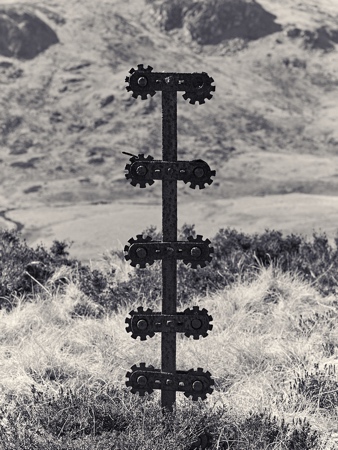
A new sequence of images titled: Totems of Possession & Control.

I've made it into a small limited edition (25) book with six images, four images shown here.

Totem 2 © George LoganTotem 1 © George LoganTotem3 © George Logan

Totem 4 © George Logan


Always something of interest

05-01-2026

A pre Christmas walk

Finely, I managed to get out to the hills and the now, for me, a well trodden walk to a rather nice bothy (shieling related or not) a couple of miles in from the head of Strathardle. Walking past the deserted farmstead of Stronhavie and taking the old Blair Atholl route that snakes up the hill. With a little corner cutting you at first come across an old wall created I think to guide livestock coming down or up to/from the main road, I suspect more down, perhaps cattle to the fair at Kirkmichael or heading further south via Glen Derby. When passing the wall this time with a low sun I noticed a very faint continuation from what I thought originally as the large stone marking the end, there is also possibly a fallen stone post, so maybe there was a gap allowing for some further redirection downslope. Anyway I’ll have to amend the DES description I submitted, though the purpose of the wall remains.

Approach to Crungie Dubh.Once up the steep slope the ground flattens out and you face Crungie Dubh hill, where the bothy sits above. Its lower area I can imagine being at times a stance before the cattle were moved down to the strath.
The bothy sits above and overlooks the route for a full 180 degrees, with good visibility to distant hills. It's a perfect spot, sheltered with a crag to the north and where small pens contemporary with the bothy had been located. The bothy is well built up and has what looks like a small end byre being a later addition, in general respects a standard design. Just down from the bothy is a cracked and split boulder that forms a perfect seat, that I’m sure would have been frequently used, keeping an eye on movement or for a relaxing smoke on some pipe tobacco.

crungie dubh seatAfter a quick bite to eat as the temperature despite the sunshine was not conducive to sitting or standing around I decided to head back down via an alternative route that might reveal the track indicated on Roys map that skirts around Balgholan Craig by Brerachan Water. I know it’s occasionally used with a quad bike by the local farmer but it’s not obvious that this was a regularly used part of the way to and from Blair Atholl as clearly indicated on Roy’s map

The Roy route I can also not see as being used for any movement of particularly large herds of livestock as it passes right by the small settlement of Balgholan that at some point became the sheep fank, the footings of settlement buildings can still be found. Perhaps the winding road up and down via Stronhavie was a later more practical alternative and adding little to the distance. Or the dominance of sheep farming just took over. As it turned out I couldn’t discern the old Roy marked route. 

lower dykeOn the south face of Balgholan Craig you come across a nice lichen covered wall, the head dyke, that snakes around the hill, a gap of collapsed walling acting as a frequently used open way for animals. What is intriguing however is another near parallel but evidently a much older wall, much more ruinous and at its lower reaches towards the Brerachan Water being virtually non existent and devoid of stone walling, just a heather covered earthen dyke. Quite what the reason for a newer wall above and just extending a short distance up the hillside would need further research. Another oddity is why the older wall was not completely robbed of its stone and thus for it to cease being a barrier for animals, not that there is much left to inhibit any. 
Heading further down towards the fank I came across the footings of a lone bothy with two small enclosures, though one might also have been another but much smaller bothy or small byre, there is another small enclosure nearby. None of these are recorded.

Heading down towards the fank and the track back to Stronhavie. I sense my way down hill amongst the rocks to the fank was the route people in the past might have walked even though nothing indicated it being particularly so, a ghost path.

The final stretch along the farm track and then a drive home.


top wall head dykebothy footings


Top image; looking back towards Strathardle. Top left; a handy seat just below the bothy. Right image; the old wall looking down towards Brerachan Water. Bottom left image; the top head dyke wall. Bottom right image; grass covered footings of bothy near the Balgholan fank, looking down towards Strathardle.


The 21st century shieling

09-11-2025

Update: 8 August 2026

Unfortunately the youTube video has been removed that the text below refers but I have added another video showing a similar way of life, taking livestock to fresh grazing grounds.

This is a very interesting and excellent film (sadly no English subtitles) about moving cows up to graze the mountain meadows that mirrors in many ways how it would have been in 18th century Scotland, taking the cows to the shielings. Except then there was no electricity or wi-fi.
They are moving their cows from their village to the 3,100 meter high Tahpur plateau, North Eastern Turkey, surrounded by the Kaçkar Mountains. There the cows will graze while the women make cheese. An interesting life and the children certainly seem to be enjoying it even while putting in work duties of their own.


Riecharlotte

24-10-2025

A recent walk to Riecharlotte (Charlottes shieling) to the sound of roaring stags.

I walked in from the top of Strathardle via Brerachan commercial woodland, that then takes you to open moorland near an old shepherds hut now a ruin called Arnbeathan. The area of crags up to the left have been recently recorded (published in Discovery and Excavation Scotland) referenced as Cona Chreag as per the name of the crag, with twenty plus huts, a previously unknown shieling well worth exploring.
Riecharlotte was the destination so a fairly straightforward heading initially by another shieling called Ath nam Breac, easily spotted as it nestles around an exceedingly large erratic boulder. Ath nam Breac is by the west bank of a ford that crosses the Allt na Leacainn Mòire burn (that becomes Brerachan Water) and the ford is on the the old Strathardle to Blair Atholl track. Interesting to note that no bridge was ever constructed here despite how much it must have been used over the decades.

Riecharlotte © george loganContinuing onto Riecharlotte you cross over a well constructed and very straight dyke that heads down the left side of Lòn Mòr a flat area ideal for easily guiding livestock after their hill route, the wall acting as a property boundary over the years. The old road is actually on the left of the wall. A bit of livestock droving management thinking required here, as you would think the flat and wide Lòn Mòr (bottom pic) would be easier for a herd of cattle, how it all worked in practice and with at times tetchy owners is something of a mystery.

A little further on by the side of Allt na Leacainn Mòire you reach Riecharlotte, with its short row of houses and the occasional seperate buildings and enclosures. Named after Lady Charlotte Lude. Charlotte was a staunch Jacobite who entertained Charles Edward Stuart, she reportedly bullied tenants into following the cause and one assumes also to fight or have their houses burnt down and apparently there was several instances were she actually did so. The 2nd Duke of Atholl her immediate land owning neighbour and who had many of his own tenants working the land was of Hanoverian persuasion, all making for an interesting period and place in history. Not a good time to be a tenant of either.
She was also part of a dispute in 1749 over the exact position of the ford at Ath nam Breac that would indicate the boundary march. A dispute that would appear again in 1778 when some animals strayed over the march onto Lude ground, such was the territorialism and animosity even in such a remote and one would think forgiving landscape. Charlotte died in 1787 aged 77.

So we can assume that the settlement dates from early to mid 18th century and the construction of what we see now initially paid for by John Robertson of Lude, Charlottes husband. With it perhaps being much older in the form of a small shieling with just turf walled huts, that is a shieling rather than a settlement that it subsequently became.

There are estimated to be ten buildings at Riecharlotte, I didn't count, one still with an upstanding gable, the rest quite ruinous, a large enclosure is just behind the buildings that are partly sheltered from a westerly wind by a low ridge. As was relatively common settlements often had a grain drying kiln, the Scottish weather not being that conducive to dry sunny weather, Riecharlotte has two kilns that are in a reasonable state with the bowls and construction still clear (second pic). The rent in 1787 was £40 0s 0d excluding services and casualties.

Grain drying kiln Riecharlotte © george loganThat Riecharlotte is not scheduled is quite odd but then very little of the area is. A full and comprehensive survey from Glen Tilt to Glen Fernate would make for quite a study. Revealing amongst other things just how busy and productive the landscape once was. That large numbers of people once populated what we now perceive as an empty and desolate landscape. A landscape devoid of trees but that is probably how it had been for centuries if not a thousand years or so (more research) and that notions of ‘re wilding’, a large part being the creation of forestry that can be very destructive of a once thriving cultural landscape. Yes specific archaeology especially when tree planting is avoided but its presence and context become shrouded and ultimately overwhelmed and lost. Feature sites are 'protected' but the likes of field boundaries aren't. There will almost certainly will be archaeology that we currently cannot see and that would be completely lost, whose remains are covered by time and dormant. A Lldar survey would reveal more but not all, perhaps that should be a prerequisite of any land transforming development, even though costly. We should be thankful meanwhile for some good aerial satellite imagery to reference back to when much becomes lost but that is sadly of small consolation.
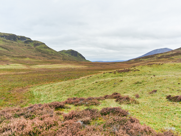
Riecharlotte is definitely worth a visit and I’ll certainly be going back to explore the area thoroughly, without the roar of stags next time. There is a interesting looking bothy and enclosure on the opposite hillside over the burn to look at also, let alone the numerous other sites that require a bit more of a hike.

Riecharlotte © george loganLon Mor


*'The Old Roads to Strathardle' by John Kerr is definitely a must read for information on this area.

Grid reference: 56.77087, -3.6715

Two Zoomy panoramas of the area taken a year or so ago: LINK and LINK


Castle Menzies covid memorial sculptures

12-10-2025

Covid sculpture © George LoganBack in May I photographed some sculptures created by Alec Finlay. These can be found in the Castle Menzies walled garden and well worth a visit. Castle Menzies is near Aberfeldy.

I wasn't commissioned but as a guest for the launch and of course I always have a camera and it was such a beautiful day and the sculptures are amazing. They are in the form of a trellis (support) and have the outline of nearby hills with an internal form that is both trees and people, plus a line of text. A fitting covid memorial. Alec used one for a subsequent newspaper article.

Covid sculpture © George Logan

Covid sculpture article © George Logan


Druimchardain ~ Year completed

30-09-2025

One day a month, rain or sunshine, mostly a mix. My visits to the garden only lasted a few hours each visit and with a large area to wander around, to not just see images that might work but also keep in mind that it was the creation of Geoffrey Dutton, I needed to reflect on his mindset as creator of what he referred to as a marginal garden, complimenting as much as possible. It was quite a challenge and some visits were a struggle but one I was prepared for.

I repeated only one view, that of the bog garden area, for a clear element showing transformation. There was also some overlap from the first visit in September 2024 and September 2025.

This is the link to the Druimchardain gallery page: HERE

The next stage is to edit down to have a good series of images and then hopefully find a suitable publisher. The gallery is only a quick edit with many I'm sure being rejected.